See what’s real, not what’s assumed
Plan with confidence by bringing engineering intent and real world reality together
Planning work offshore is never simple. You’re often juggling drawings, static 3D models, 360 images and point clouds – trying to understand what was designed, what’s actually there, and what that means for safety, access and execution. Too often, the answers only come once teams are already offshore, when change is expensive and disruption is unavoidable.
The R2S 3D Model Viewer brings clarity earlier.
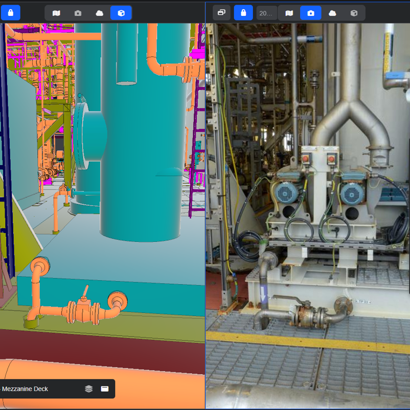
By viewing your 3D models side‑by‑side with high‑fidelity 360 imagery or point cloud, R2S gives you one trusted view of your asset – so you can validate assumptions, surface risks and approve work with confidence, before you mobilise.
One trusted view of your asset
Design models show intent. Reality data shows what’s really there.
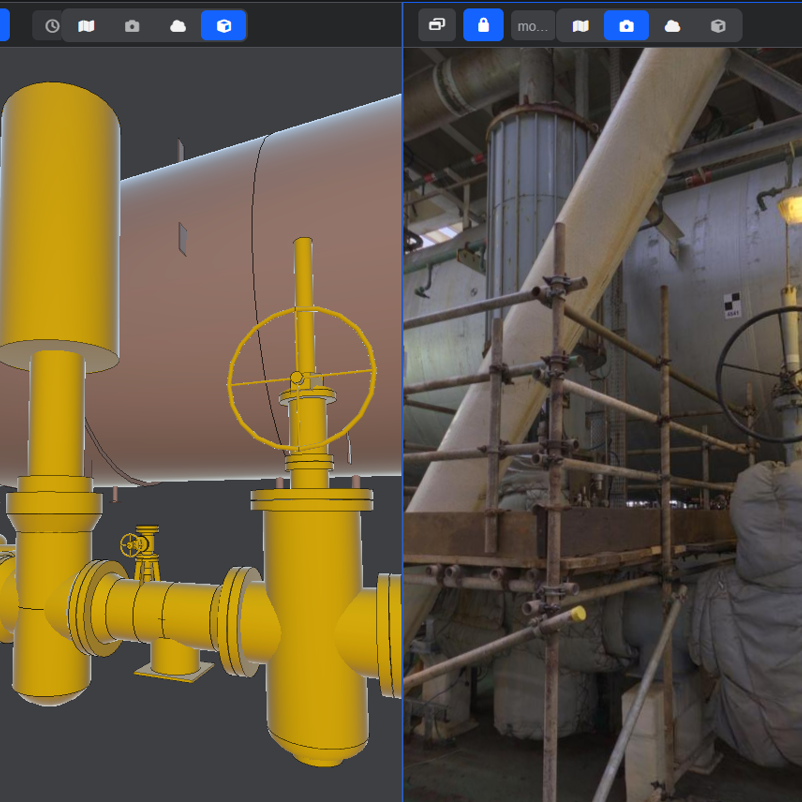
When those views live in different systems, gaps are easy to miss – and those gaps often show up too late. The R2S 3D Model Viewer brings both together in a single, familiar environment, synchronised to the same location.
That means you can:
- Move freely around your asset using the 3D model, not just fixed camera positions
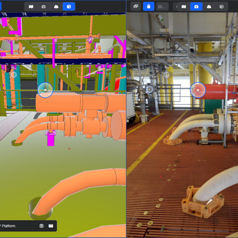
- Open the 3D model alongside 360 imagery or point cloud in a split‑screen view
- Understand space, access, interfaces and constraints in real context
The result is fewer surprises offshore, safer planning, and better‑informed decisions.
Turn static models into decision ready insight
3D models are valuable – but on their own, they don’t always tell the full story.
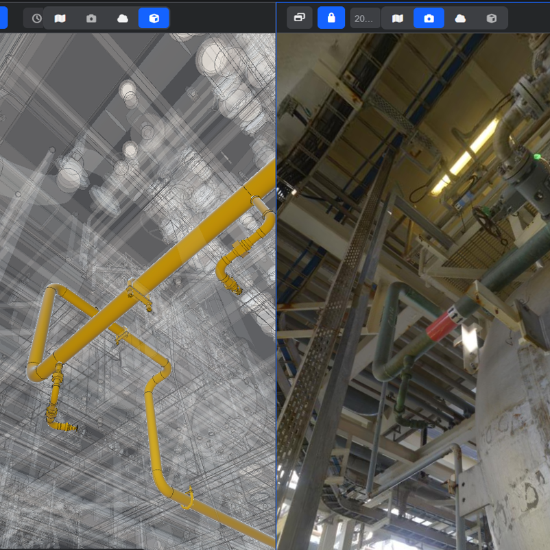
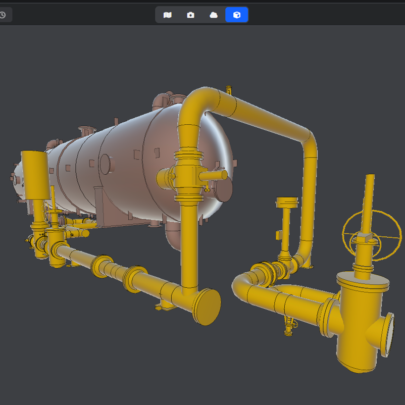
With R2S, your models stop being static files and start actively supporting decisions. By comparing engineering intent directly against as‑built reality, you can quickly see what can be trusted and where caution is needed.
Even when models are incomplete, imperfect or out of date, that comparison adds confidence. You avoid throwing away valuable engineering data, while still protecting the quality of your planning.
Find what you need, when you need it
Using reality data alone, finding equipment or following a pipe run can be slow and frustrating – especially in congested or hard‑to‑see areas.
The R2S 3D Model Viewer makes it easier to:
- Search for equipment and navigate to it in seconds
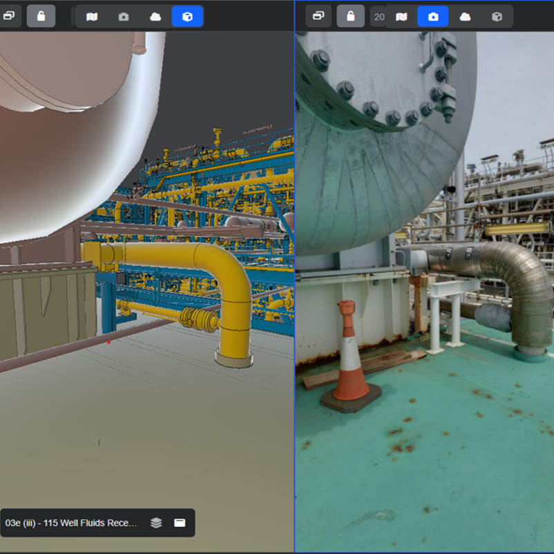
- Isolate or ‘ghost’ individual components to reduce visual clutter
- Follow pipework and systems through complex areas
- See how everything fits together before work begins
This allows more walkdowns to happen onshore, in minutes – not offshore, at cost.
Reduce risk before it reaches the deck
Once work is mobilised, assumptions quickly turn into exposure.
By validating space, access and interfaces early, the 3D Model Viewer helps teams surface risk sooner, challenge assumptions earlier, and align around the same understanding.
That leads to:
-
- Fewer late surprises during execution
- Safer work scopes and reduced HSE risk
- Less re‑planning, rework and unplanned downtime
- Greater confidence that work can be executed as intended
Bring teams into alignment
Decisions are easier when everyone is looking at the same thing.
With synchronised views across 3D models, point cloud and 360 imagery, onshore planners, offshore teams and contractors share the same asset context. That reduces interpretation gaps and makes it easier to communicate access routes, constraints and execution plans.
Clearer alignment means smoother mobilisation – and fewer issues offshore.
Plan it right, first time
The R2S 3D Model Viewer helps you make better asset decisions before you commit time, budget and people offshore.
-
- Validate assumptions against reality
- Move more planning onshore
- Reduce risk, rework and delays
- Approve work with confidence

Discover how the 3D Model Viewer supports safer, more confident asset planning.
 Annual Report 2025